Diploma project
Autumn 2023
Institute of Urbanism and Landscape
The project proposes an accumulating copperhancing planning of landscape through scales to handle flooding and future water events in the riverways of the Norwegian mountain landscapes, based on the logic of water and topograhy. Through digital water accumulations and tracings of the valley and river in Hemsedal, the project challenge the act of separation of land and water. This seperation”line” has come into sharp focus during extreme floods, with proposals of walls, levees, natural defenses, land retirement schemes and recomendations for retreat. These responses raise questions on where this line is drawn, but they also raise questions on the separation that this line facilitates. Is this separation found in nature or does nature follow from its assertion? When people see flood, they see water tragressing this line.
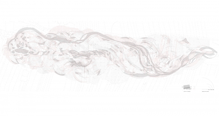
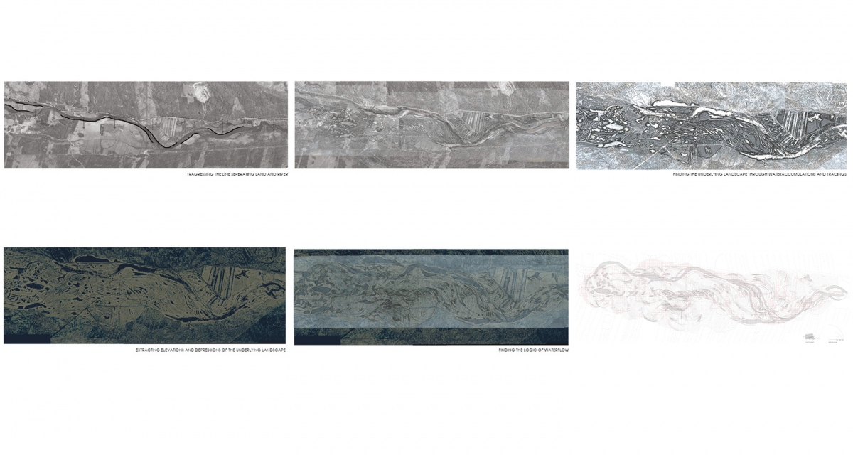 Tracings of water accumulations, extracted into digital models, function as a method to find the underlying landscape and propose a siteplan of potential waterflows and escapes if the water were let free from its predicted wayes of the river and into the landscape. The micro topography still speaks about the dynamics of the water and the past wet landscape. The flood distributes these spaces, proposing its space during spring-flood and demanding its space during extreme flood. This becomes a landscape which can take the floods, give the water its space and propose an organisation of water and land due to the logic of water; a landscape design embedded from the present geological and climatic record, erasing the line seperating land and water.
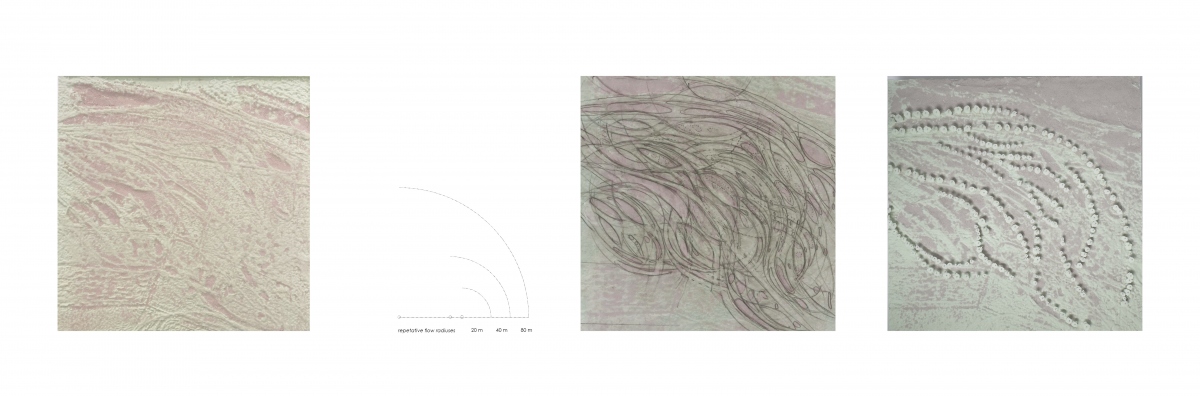
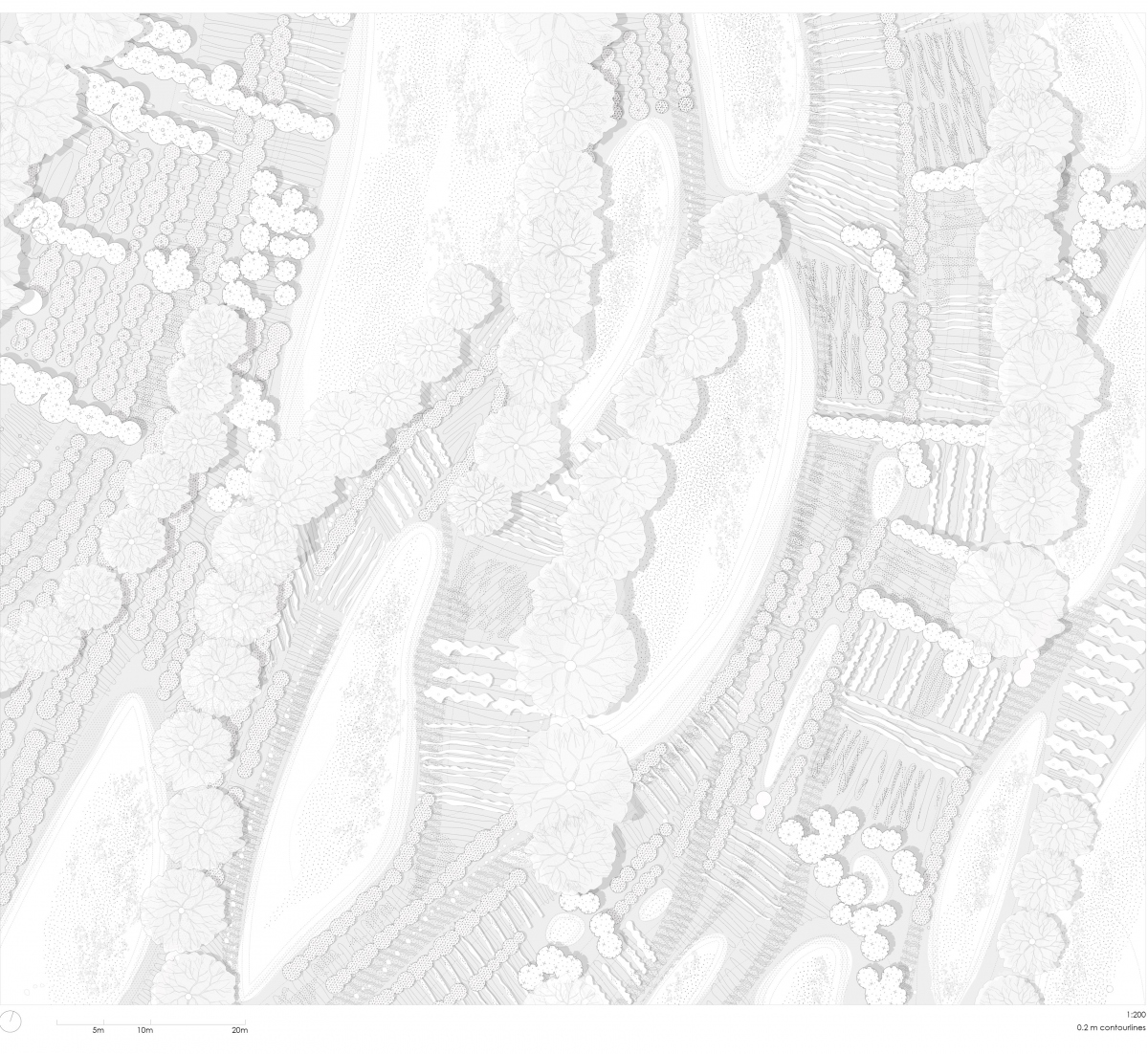
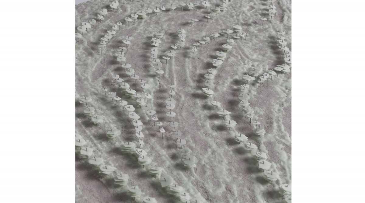
Tracings repetative waterflows of spesific dimentions can pronounce where the water through time has placed and conducted the soil.
When the flows collide or almost meet, they leave concaves and convaxes, depressions and elevations.
The waterflows reorganisation of soil finds a new duett between land and water and areas where the land can be provided to the waterevents. When the riverwater raise to a certain level it will flow over its edges, and escape into these areas. One of these areas is the meanderings of the river.
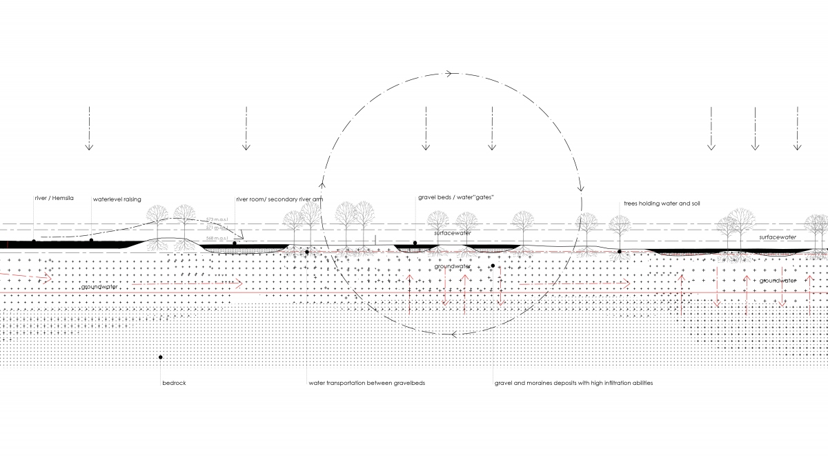
On a day of heavy rains the water arrives. From the mountains it comes as runof into the river, some of it infiltrated in the soil. The ground water is raising and the soil of the valleyfloor is filled with water. The moraines deposists appears as repetative sequences under the surface, becoming ””watergates” with their high infiltrationabilities, tranfering and infiltrating water between the surface and the deepsoil. These watergates appears as gravelbeds.
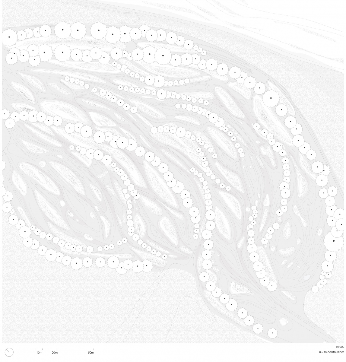
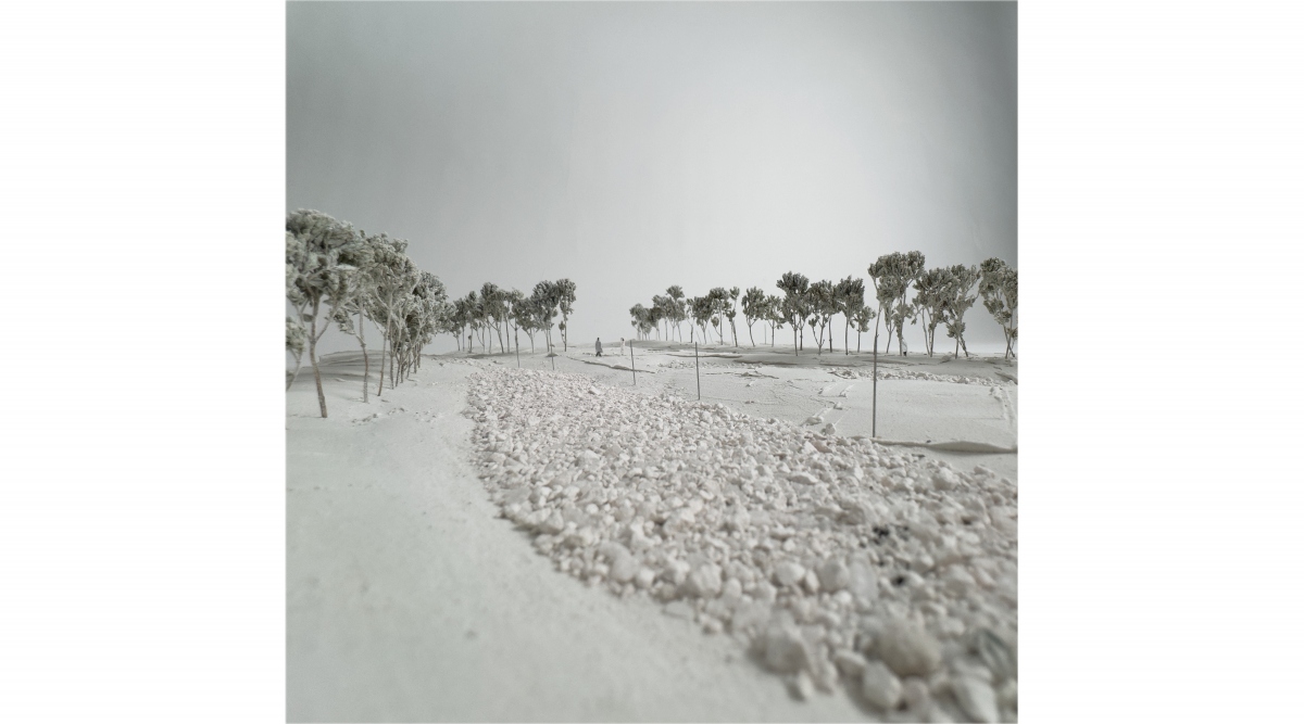
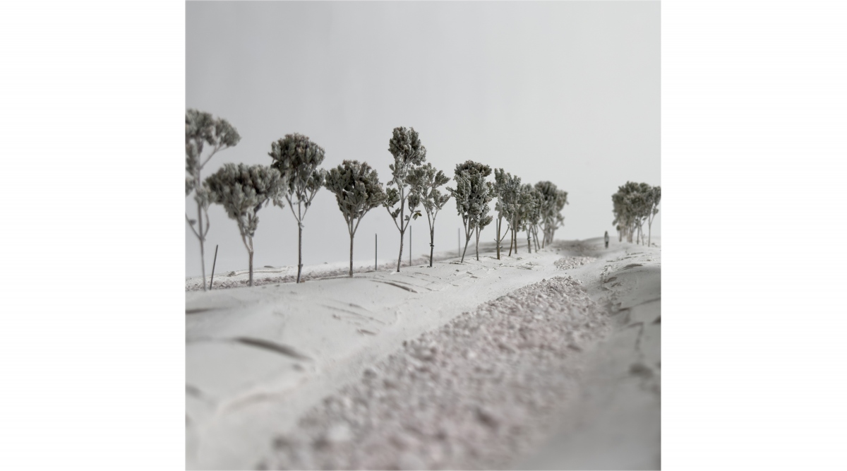
The meanderings of the river, are pronounced through vegetation, soil and gravel. The flows and dynamics of the river becomes visible through lines of vegetation and water. When the river escapes is predicted wayes, during heavy rain and springflood, it enters this stage and fills in the meanderng tracings.
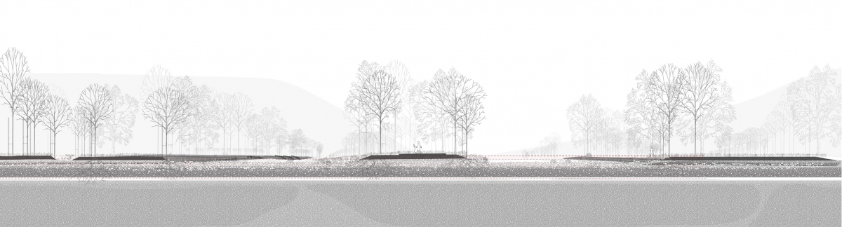
Within this landscape the vegetation lines create sequences of narrow and wide spaces where the meanderings almost meet, and where they move apart. The bands of soil and the gravelbeds are created by moving the first layer of topsoil to the side, revealing the moraine deposits and gravel underneath. The removed soil placed aside, becomes soil bands of raw earth, with cultivationvalue.
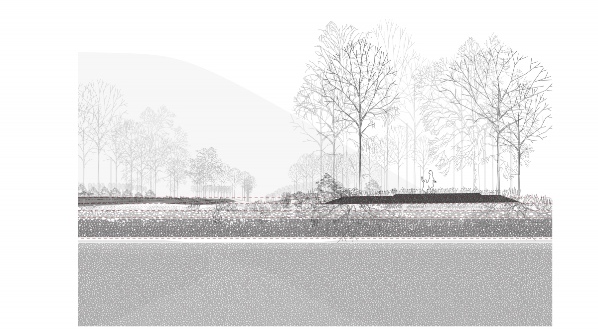
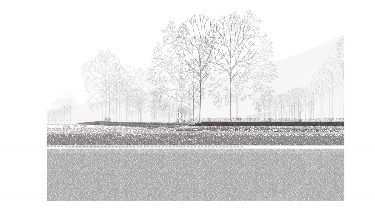
The water will infiltrate through the gravelbeds which becomes watergates between the surfacewater and groundwater. Through this act of moving the topsoil aside the original infaltration abilitites of the landscape is reactivated: The geological record of moraindeposits and gravel and the present climatic record of water events meets. The tracing of waterflows, and the meandering echos finds a lansdcape were the water can escape the riverbed into the provided land. The river as a dynamic element becomes visible and preformative, leaving reminders and traces of its forces and wayes.

Maria Charlotte Thoner / Maria.Charlotte.Thoner@stud.aho.no
Tracings of water accumulations, extracted into digital models, function as a method to find the underlying landscape and propose a siteplan of potential waterflows and escapes if the water were let free from its predicted wayes of the river and into the landscape. The micro topography still speaks about the dynamics of the water and the past wet landscape. The flood distributes these spaces, proposing its space during spring-flood and demanding its space during extreme flood. This becomes a landscape which can take the floods, give the water its space and propose an organisation of water and land due to the logic of water; a landscape design embedded from the present geological and climatic record, erasing the line seperating land and water. Tracings repetative waterflows of spesific dimentions can pronounce where the water through time has placed and conducted the soil.
When the flows collide or almost meet, they leave concaves and convaxes, depressions and elevations.
The waterflows reorganisation of soil finds a new duett between land and water and areas where the land can be provided to the waterevents. When the riverwater raise to a certain level it will flow over its edges, and escape into these areas. One of these areas is the meanderings of the river.
On a day of heavy rains the water arrives. From the mountains it comes as runof into the river, some of it infiltrated in the soil. The ground water is raising and the soil of the valleyfloor is filled with water. The moraines deposists appears as repetative sequences under the surface, becoming ””watergates” with their high infiltrationabilities, tranfering and infiltrating water between the surface and the deepsoil. These watergates appears as gravelbeds.
The meanderings of the river, are pronounced through vegetation, soil and gravel. The flows and dynamics of the river becomes visible through lines of vegetation and water. When the river escapes is predicted wayes, during heavy rain and springflood, it enters this stage and fills in the meanderng tracings.
Within this landscape the vegetation lines create sequences of narrow and wide spaces where the meanderings almost meet, and where they move apart. The bands of soil and the gravelbeds are created by moving the first layer of topsoil to the side, revealing the moraine deposits and gravel underneath. The removed soil placed aside, becomes soil bands of raw earth, with cultivationvalue.
The water will infiltrate through the gravelbeds which becomes watergates between the surfacewater and groundwater. Through this act of moving the topsoil aside the original infaltration abilitites of the landscape is reactivated: The geological record of moraindeposits and gravel and the present climatic record of water events meets. The tracing of waterflows, and the meandering echos finds a lansdcape were the water can escape the riverbed into the provided land. The river as a dynamic element becomes visible and preformative, leaving reminders and traces of its forces and wayes.
Maria Charlotte Thoner / Maria.Charlotte.Thoner@stud.aho.no