Diploma project
Spring 2022
Institute of Urbanism and Landscape
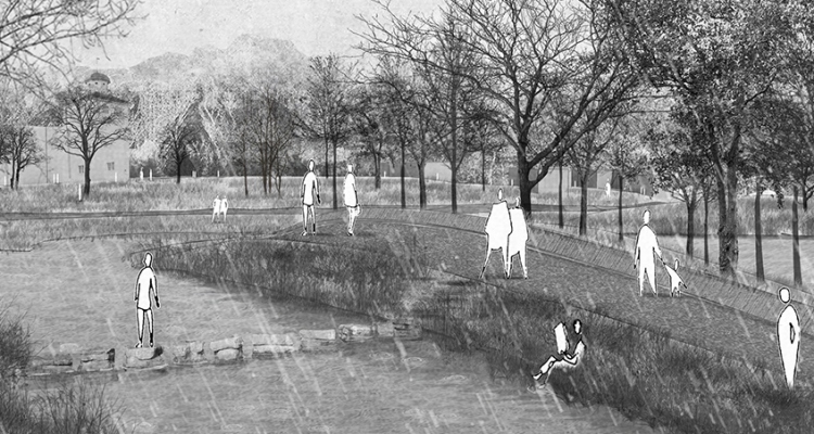
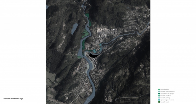
Performative landscape, named to describe landscape’s ability of adaptation, is a diploma project dealing with the dynamic and temporal conditions of precarious landscape events. The project aims to explore adaptation and risk mitigating strategies for flooding in riverways using landscape design and data driven simulations to inform design decisions and processes in the site of Kvinesdal in southern Norway. The focus of the project are landscape strategies that aim to rethink how the urban fabric addresses water, as well as challenge the idea that rivers and streams are bound to the limits of urbanity.
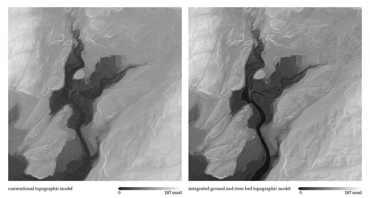
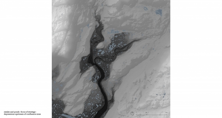
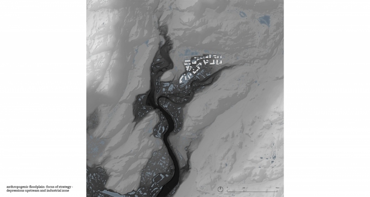
Urban centric approaches to landscape and extreme weather have made devastating flooding events more common and destructive. In the past decade northern Europe has seen the recurrence of flood events increase significantly. The diploma project seeks to approach the challenges of flood risk landscapes through a topographical lens, informed by data to access these relationships. This topographical eye starts at the watersheds of the Norwegian landscape and zooms into the morphology of the riverbed, to understands and explore the dynamics of water and ground.
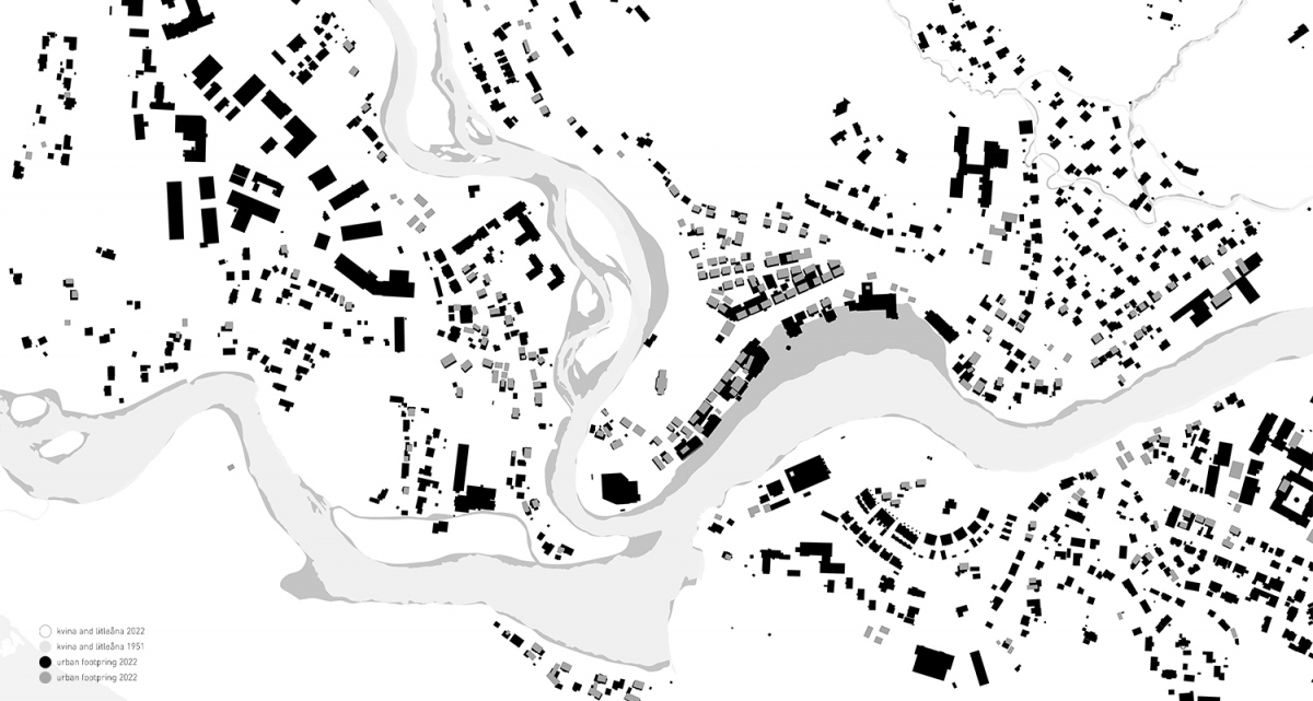
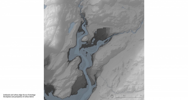
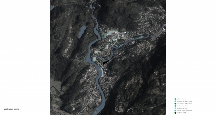
The site of Kvinesdal was chosen for the diploma project due to a combination of factors. In 2015 weather storm Synne caused flooding throughout the region, catapulting efforts of preparation, development of technology, and design of a more resilient landscape to flood. This resulted not only in securing central government funding for flood safety, but also an expansion in the data collection from the waterways in the region.
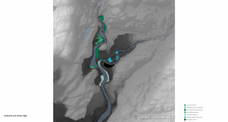
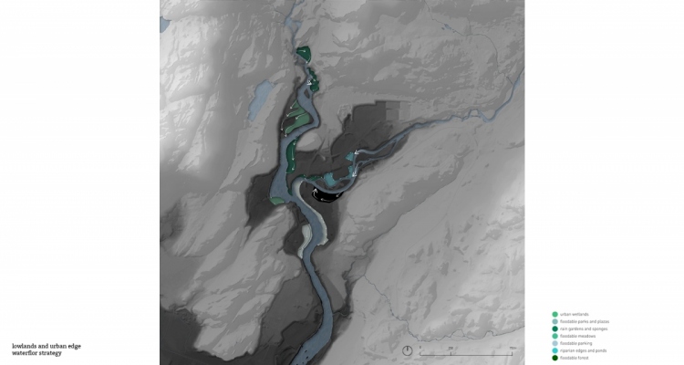
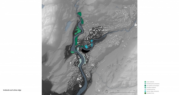
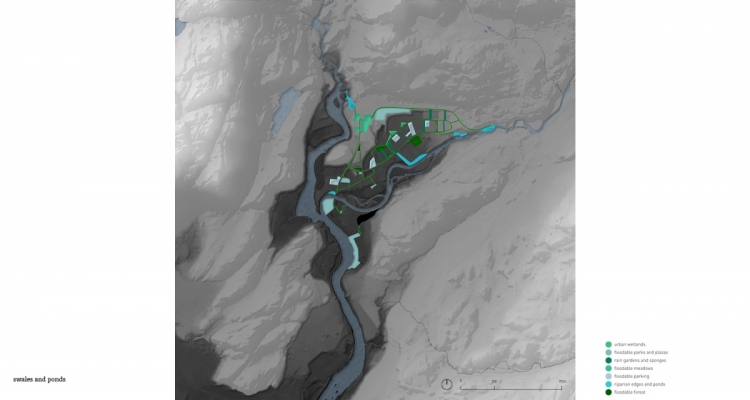
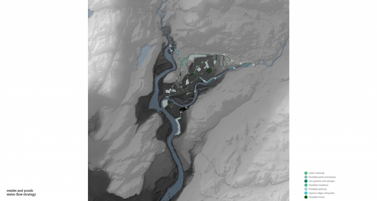
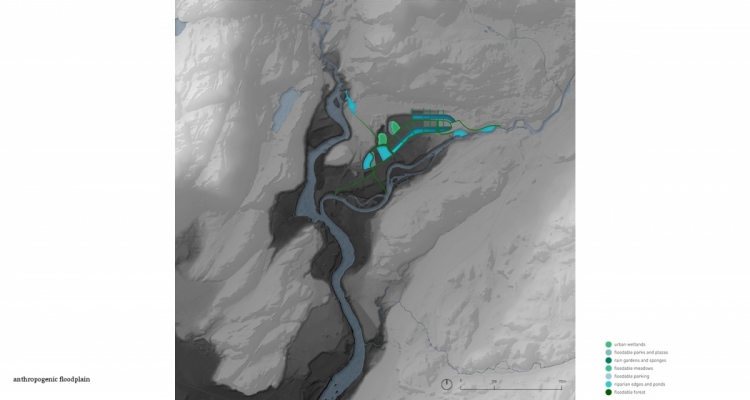
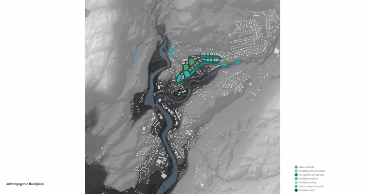
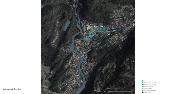
Hence, the project aims at testing three strategies with the ambition of testing the possibilities that could arise when the conventional anthropocentric relationship between water and urban form are questioned.
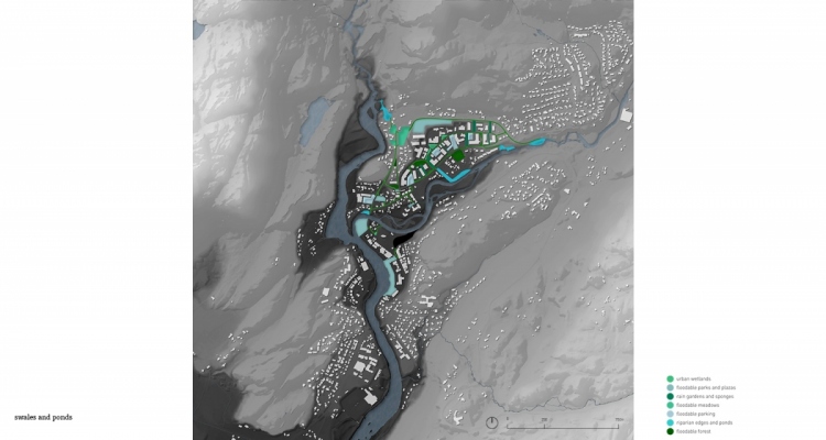
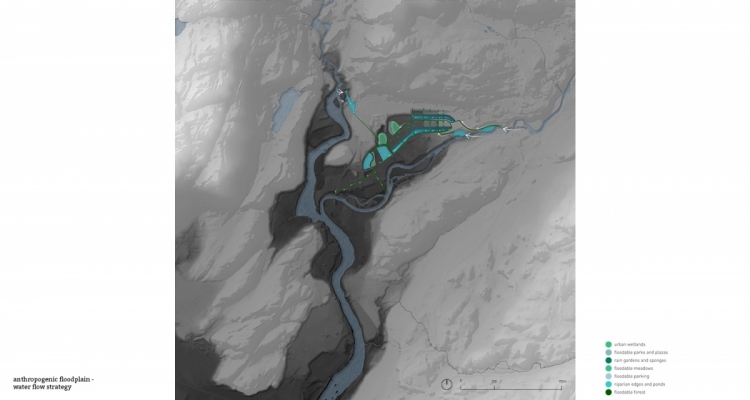
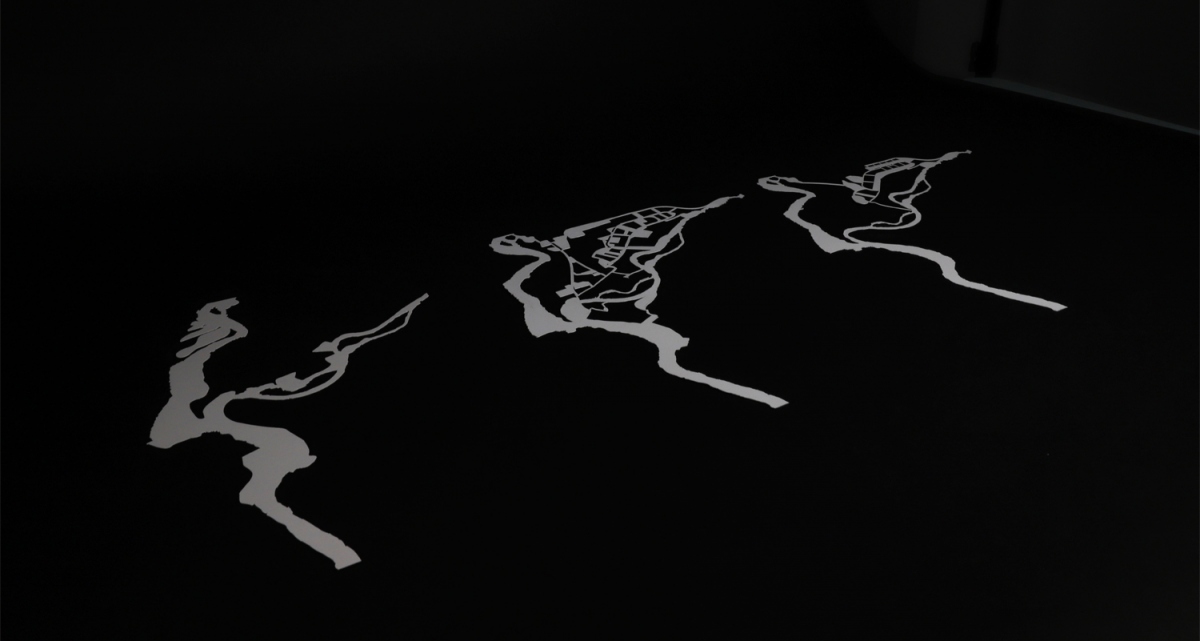
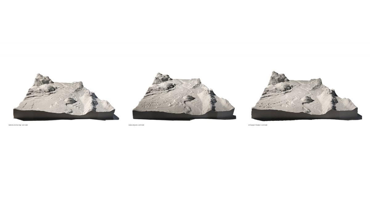
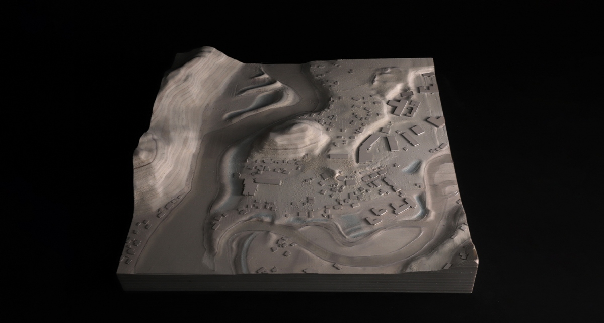
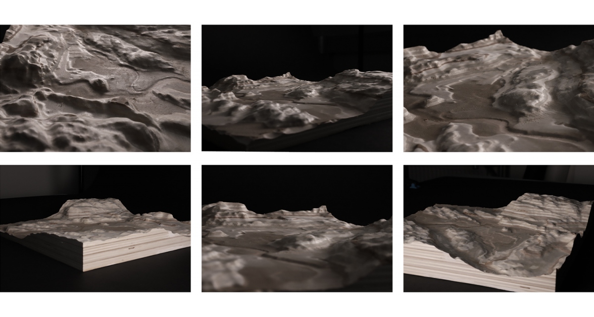
The interface of tangible landscape and GRASS GIS is used to test the ground operations proposed in the three scenarios. The technology uses a kinetic sand model of the integrated topography of ground and riverbed, a projector, and a 3D scanner to record the changes of the land operations while updating the contour lines and saving the resulting topography.
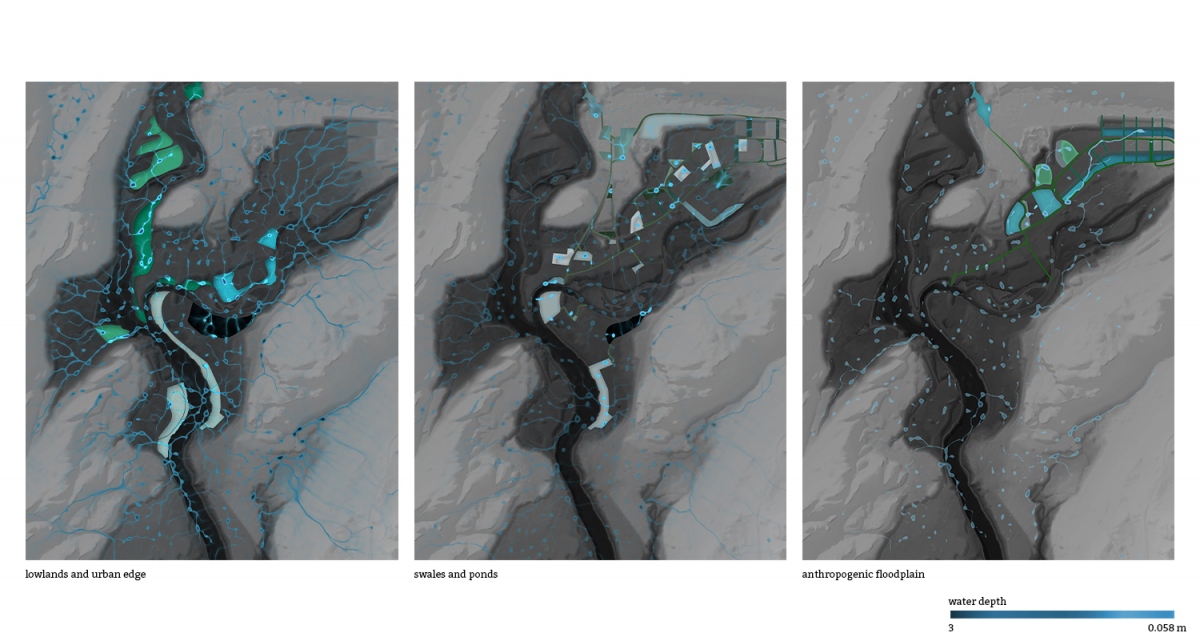
The diploma project uses the results of these tests to assess parameters of safety, and spatial quality. The goal is to present these scenarios as a potential range of possibilities for addressing the flooding problematic at the site.
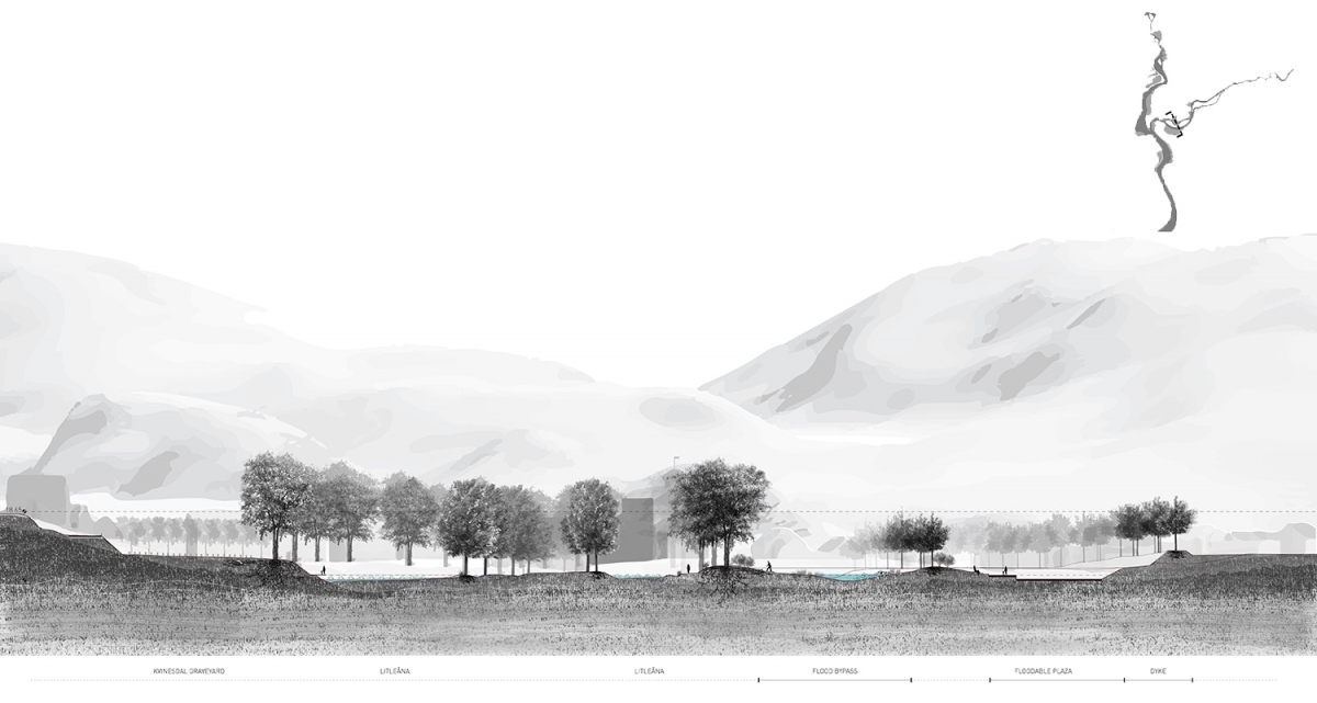
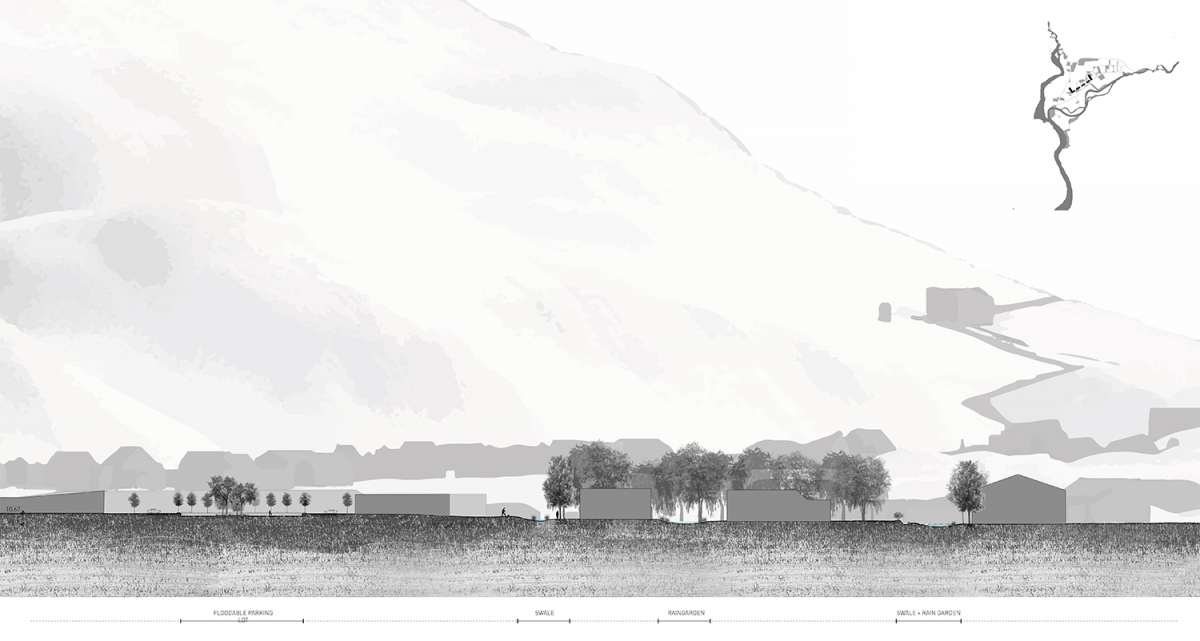
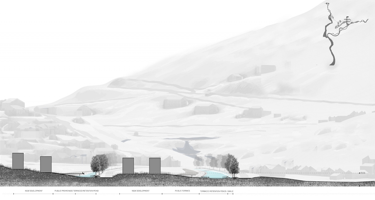
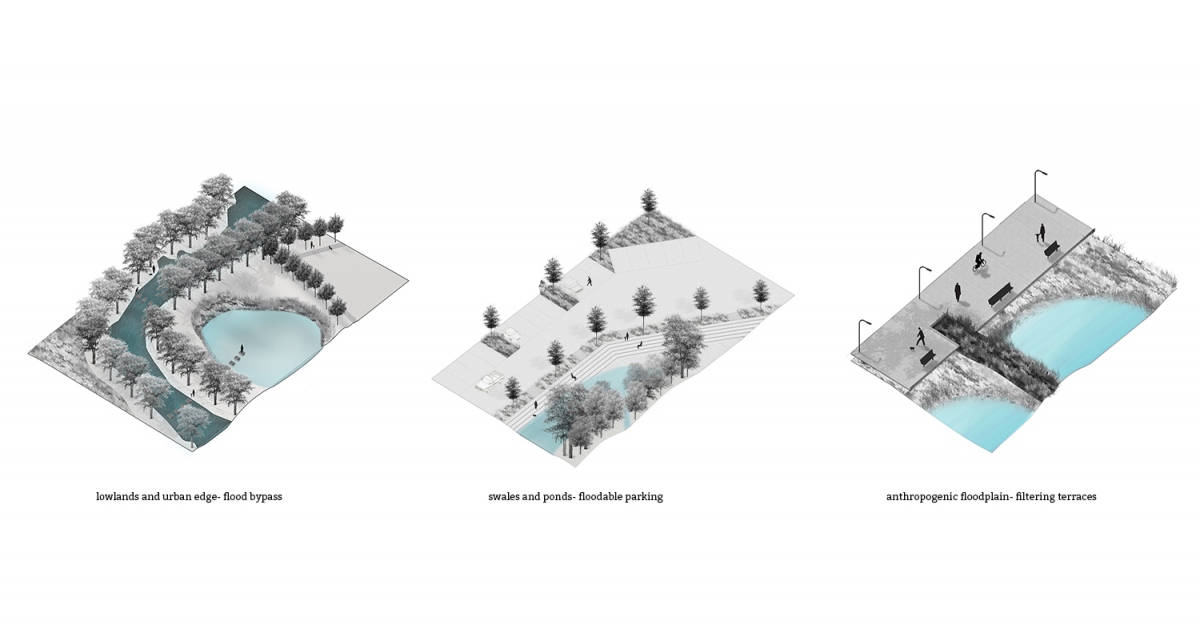
The flood risk mitigation and adaptation strategies have been designed with a different focus and starting point within water, urban and topographical conditions of the local landscape. This exploration of the dynamic and temporal, uses data driven, quantitative assessments as well as qualitative spatial design tools to present different readings of how Liknes and the Kvina-Fedafjorden watershed could use landscape scale approaches in mitigating risk and adapting to their landscape of flood.

Janina Sánchez Cárdenas / janinasanchezcardenas@gmail.com / janinasanchezcardenas.com