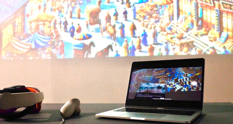
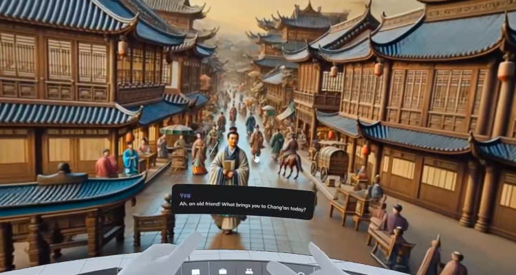
The project consists of two main components: an “Ancient China VR” game, where users take on the roles of Chinese poets to explore cultural history through VR; and a user flow that reimagines the format of educational interactions.
Yuchen Zhang
Daniel Lacey-McDermott
The project mainly consists of two parts:
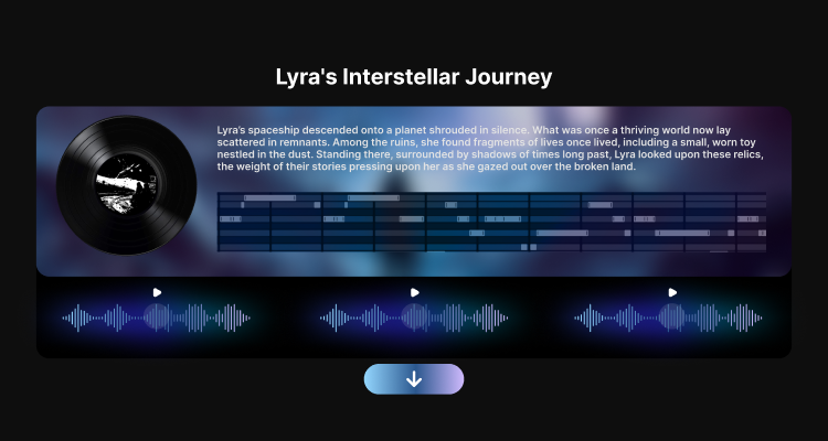
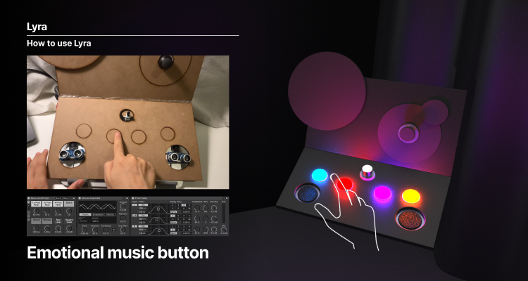
1. AI music generation online platform: Based on AI technology, it converts users’ stories into music and sounds, and supports users to create emotional music.
Sirin Altinisik
Hilde Angelfoss
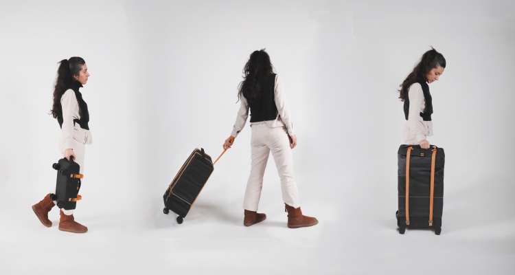
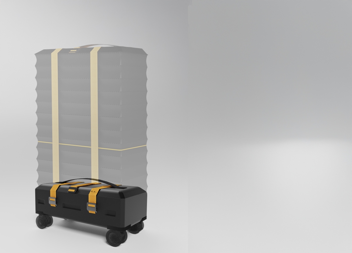
This diploma project introduces a durable, lowcost, and foldable luggage concept designed for occasional travelers. Featuring an accordion system-inspired adjustable size solution- sturdy wheels for diverse terrains, and repairable components, the design prioritizes sustainability and user experience.
Lilijean Larbi Comlan
Natalia Agudelo
Med dette utgangspunktet skiftet fokuset fra å etablere en ny juniorklubb til å utforske hvordan eksisterende ressurser kan styrkes innenfor de stramme økonomiske rammene. Målet har vært å identifisere tiltak som kan gjennomføres allerede i dag, samtidig som de legger grunnlaget for fremtidige og langsiktige løsninger.
Arindita Dey
Natalia Agudelo
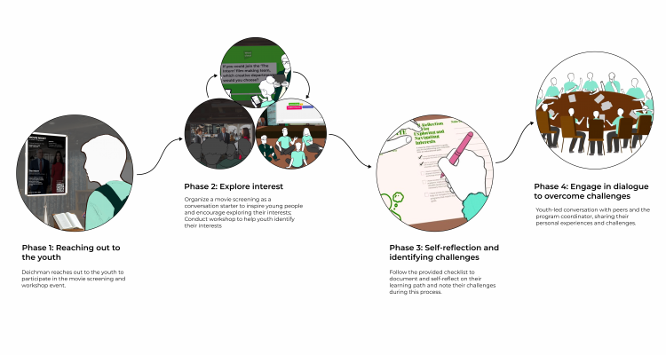
Design Scope:
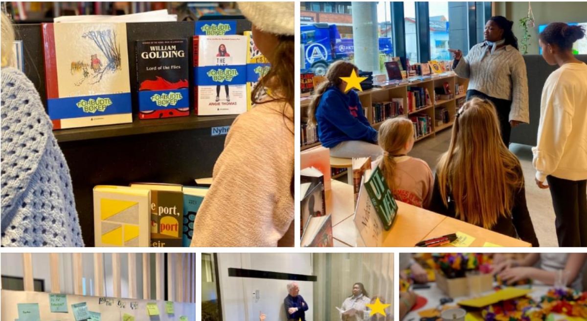
Leverage Deichman Tøyen as a hub to engage with the youth of the neighbourhood.
Utilise tailored services offered for the youth by specialised organisations and establish their relationship with Tøyen.
Design the relationship between Deichman Tøyen and the partner program coordinators.
Design the service to engage the youth to explore their interests and reflect on their personal journey and communicate with their peers to promote mutual growth.communicate with their peers to promote mutual growth.
Alexandra Gjerlaugsen
Joakim Formo Ted Matthews
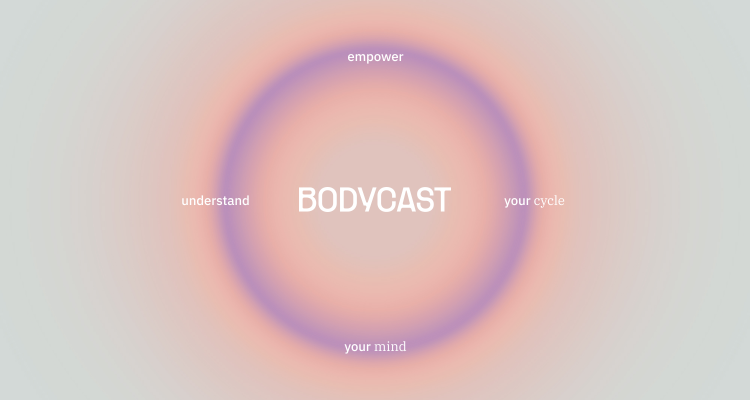
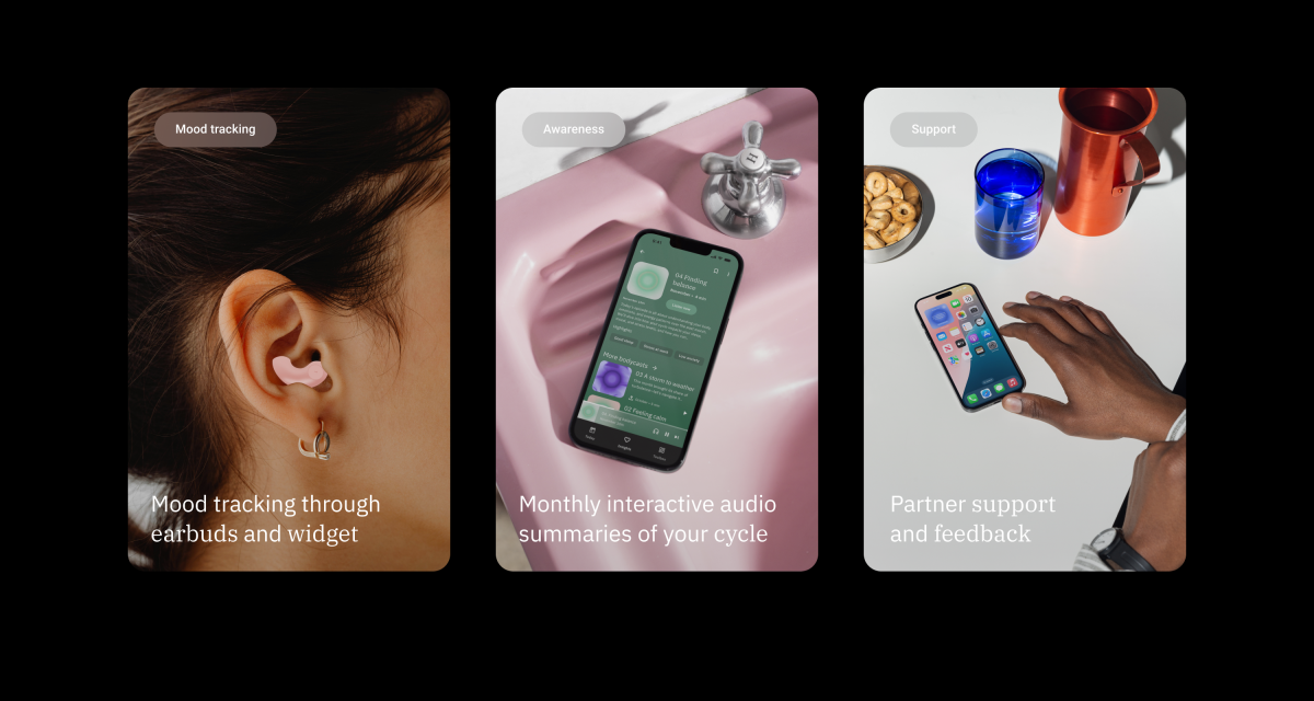
For many, self-tracking is a crucial first step in seeking help. Using a user-centered approach, I have explored opportunities to support women living with PMDD.
Kardem Gunday
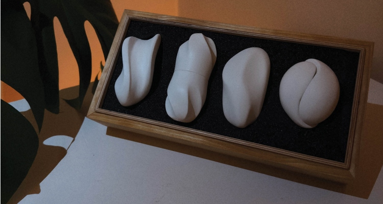
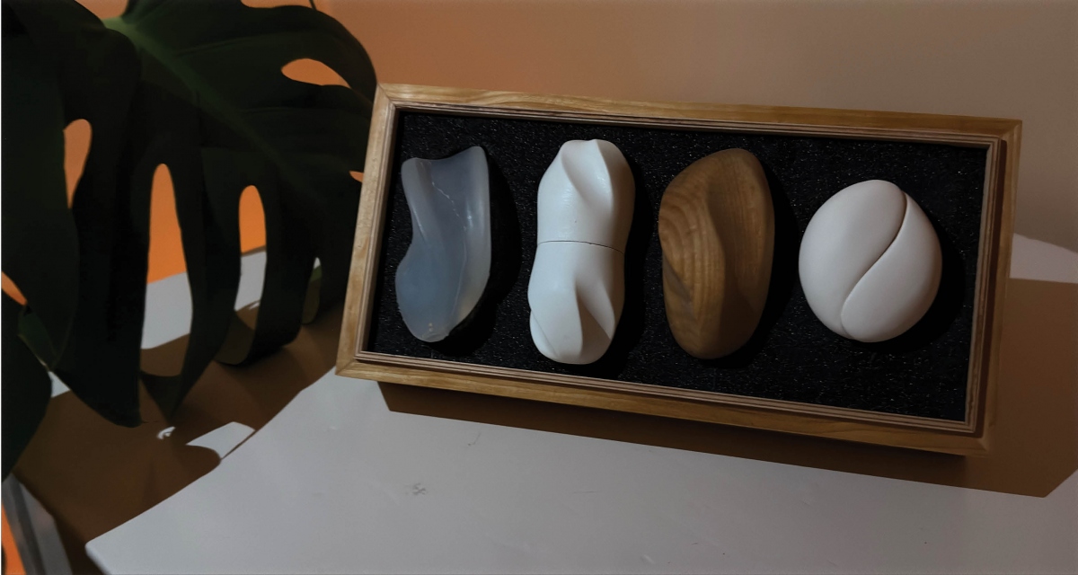
This project takes inspiration from the complexities of stroke recovery, focusing on how design can support fine motor skill rehabilitation in an intuitive and enjoyable way. By exploring forms that encourage movement, fidgeting, and tactile engagement, the aim is to create tools that not only aid physical recovery but also provide a sense of interaction and personal connection.
Mira Beichmann Krogh Trine Truchs Erga
Einar Sneve Martinussen
Minkyu Lee
Mikkel Sommerschield Jøraandstad
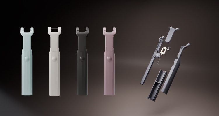
This industrial design and engineering project focuses on conducting research by design, emphasizing the product design, prototyping, and devlopment of new ideas. The goal is to ensure that the resulting designs are warkable, viable, and manufacturable. My personal objective is to create products that en-courage better user choices, expand my skills in design, production, and sustainability.