Diplomprosjekt
Høst 2021
Institutt for urbanisme og landskap
A man-made landscape with porous qualities that create multi-purpose spaces to contribute to relieving the storm flood in Santa Marta, Colombia, a city where storm floods represent 65% of risk events every year.
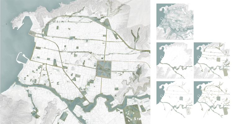
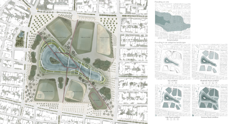
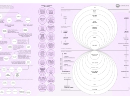
The project objective is to connect the blue and green structures in the city to use storm-water as a creator of new dynamics. By transforming the city into a sponge, with a decen-tralized system. Stormwater is managed locally on-site, creating new recreational areas in an adaptive landscape that gives identity, and creates new ecosystems not only use for humans but also for other species.
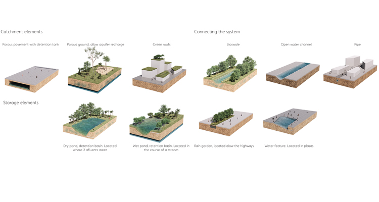
Designed to passively absorb, clean, and use rainwater, allowing the natural flow of the water through permeable surfaces. Using runoff reduction elements to stop the water be-fore it arrives at the most affected flooding areas in the city.
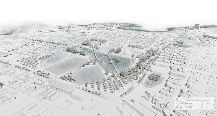
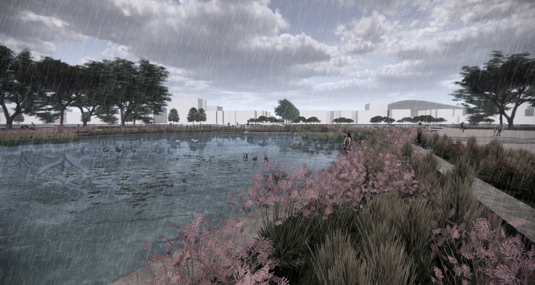
The park integrates into the porous city network, its objective is to be a multipurpose space, to create recreational spaces, and at the same time to regulate water.
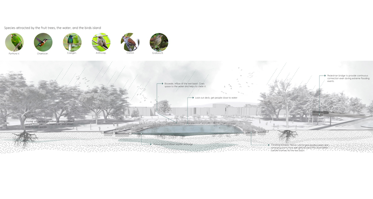
The inflow comes from the stream running from the hill at the east, the water flows through terraces with native submerged aquatics and emerging plants from the wet ground that clean the water before it arrives at the wet basin.
In moments of high floods, the system increases its flooding capacity with a combination of dry and wet basins.
Dry basins work as sports fields in dry conditions, in addition, 80% of the park is located 0.20 m lower than the pedestrian ecotone, which allows shallow flood in the whole area in an extreme flood event. A pedestrian bridge connects the ecotone and allows the normal flow of people, even when the whole park is under an extreme flood condition.
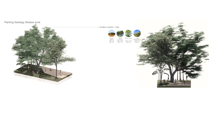
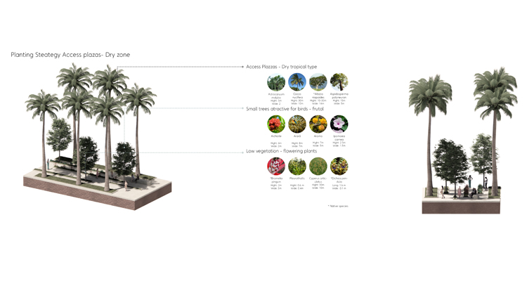
The location of the planting is defined by a series of grids, that look for a geometrical con-nection, relation, and tension with the urban fabric, the natural flow of the people, and the natural flow of the water.
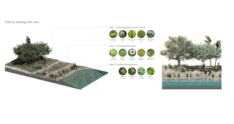
At access plazas, the vegetation continues with the diagonality connecting with the prin-cipal people flow. At the border, the planting is related to the immediate context. On the east side, the vegetation recognizes the flow of the water and makes it evident with the strips of vegetation that let the water go in between.
A series of plants between emerging, submerged and flooring has been selected on a color range of green with purple flowering. These plants are located along with the permanent water bodies and have been chosen for their ability to clean the water of heavy minerals, they filter the water before it arrives at the basin and performs well even when the storm-water has been mixed with the sewage water.
The project recognizes the need of creating spaces not only for humans but also for ani-mals, spaces that understand and highlight the natural working of the world.

Viviana Avila / viviana@vivianaavilastudio.com / vivianaavilastudio.com